1/1
Want more photos?
Request photos from the advertiserBuilding land for Sale
Podstrana€ 150,000
Note
Listing updated on 04/09/2025
Description
This description has been translated automatically by Google Translate and may not be accurate
reference: 5873-1
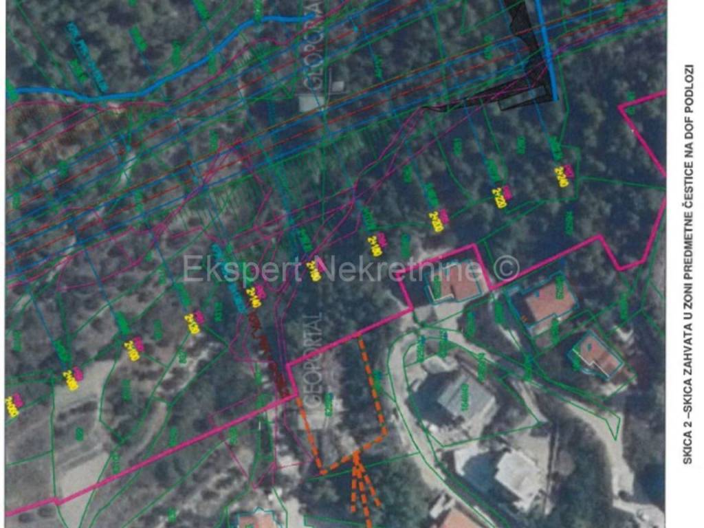
Podstrana, Strožanac, building plot 700m2, 950m from the sea and the beach.According to the new plan, a road has been laid out on the plot.The designer HC took into account the boundaries of the construction area and adapted the boundary line to the same, so that the subject c.č.z. (space delimited by light brown color - ATTACHED) is OUTSIDE the scope of the intervention. I. List of spatial plans within which the land is locatedIt was determined that the land is within the scope of the following plans:– PPŽ Split-Dalmatinska - III. ID (Official Gazette of Split-Dalmatia County", number 1/03,8/04 (repeal of the provision), 5/05 (alignment with the Decree on ZOP), 5/06 (correctionalignment with the ZOP Regulation), 13/07, 9/13, 147/15 (decisions on error corrections),154/21),– PPUO Podstrana - V. ID ("Official Gazette of the Municipality of Podstrana", number 3/06, 8/08, 3/11(consolidated text), 12/17, 14/17 (consolidated text), 13/19, 4/21, 4/23, 2/24). II. The purpose of the space is prescribed by the spatial plans of all levelsLand code k.č.z. 6259/2 k.o. Donja Substrana is located within the scope of the Spatial Planof the Municipality of Podstrana ("Official Gazette of the Municipality of Podstrana", number 3/06, 8/08, 3/11, 12/17,14/17, 13/19, 4/21, 4/23, 2/24) in the undeveloped part of the construction area of the settlement, inmixed-use zone - predominantly residential M1, in the north-eastern part within the expressway corridorroads with a width of 150 m according to the special conditions of Croatian roads.
Features
- Contract
- Sale
- Type
- Building land
- Surface
- 700 m²
Price information
- Price
- € 150,000
- Price per m²
- 214 €/m²
Additional options
